LiDAR Mapping
High-Resolution 3D data for terrain modeling, infrastructure planning, and asset management. Ideal for pipelines, powerlines, and ROW corridors.
Photogrammetry and Orthomosaic Mapping
Accurate aerial imagery and orthomosaics for documentation, inspection, and planning.
Infrastructure & Corridor Mapping
Specialized aerial mapping for linear assets like pipelines, utilities, and access roads. Supports engineering, vegetation control, and compliance efforts.
Change Detection and Damage Assessment
Before-and-after mapping to assess storm damage, erosion, construction progress, or encroachment.

Topographic Surveys
Detailed elevation models and contours to support site development, grading, and drainage design
Asset Documentation & As-Builts
Geospatial documentation of existing or newly constructed infrastructure for contractors, utilities, and municipalities.

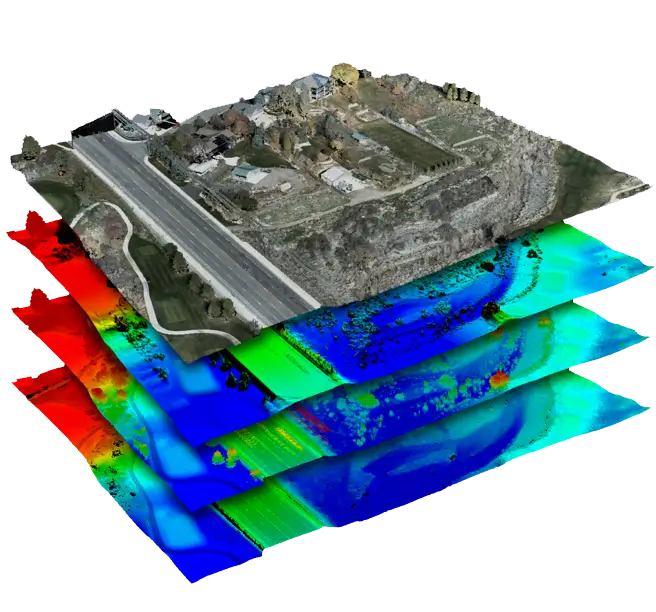
Data Processing and Deliverables
The value of drone data lies in how it’s delivered. American Geospatial provides fully processed data tailored to your workflow. Our deliverables include:
Orthomosaic maps, DSM/DTM models, and contour lines
3D point clouds compatible with CAD and GIS systems
Volume and area calculations for material or terrain
Detailed reports for asset managers and field crews
Fast delivery via cloud-based platforms
We turn raw data into the insights your team can act on.